
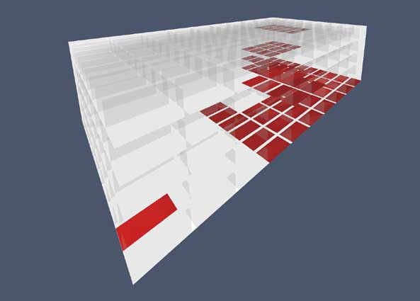
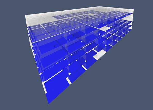
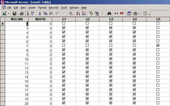
Voxel queries using a microsoft access database and CAAD + GIS software.
Voxels are three-dimensional equivalents of pixels. They are 3-D cubic cells arranged as an array, each having a unique position within the array and an inherent topology. The potential for 3D design and analysis allows us to supercede the figure/ground flat map which treated all buildings as equal in height. The voxel incorporates all CAAD and GIS functionality into one model.
![]()